العربية

NASA Image and Video Library

Records indexed under NASA Image and Video Library, with original identifiers, source links and item-level rights evidence. This is the imported selection, not the institution’s entire holdings. Verify the originating institution when the source is an aggregator.

4,093 matching records; original descriptions and titles are preserved. Search and filters →

Verify the evidence · Cite an item or clip · Rights

2016NASA Image and Video Library

ORACLES Campaign: B-Roll 1

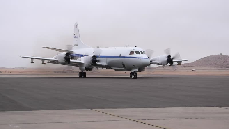
Southern Africa produces almost a third of the world’s vegetative burning, which sends smoke particles up into the atmosphere, where they eventually mix with stratocumulus clouds over the southeastern Atlantic Ocean. The Observations of Clouds above Aerosols and their Interactions (ORACLES) study is investigating how these particles impact the stratocumulus clouds, which play a key role in both regional and global su

2016NASA Image and Video Library

ORACLES Campaign: B-Roll 2

Southern Africa produces almost a third of the world’s vegetative burning, which sends smoke particles up into the atmosphere, where they eventually mix with stratocumulus clouds over the southeastern Atlantic Ocean. The Observations of Clouds above Aerosols and their Interactions (ORACLES) study is investigating how these particles impact the stratocumulus clouds, which play a key role in both regional and global su

2016NASA Image and Video Library

ORACLES Campaign: B-Roll 3

Southern Africa produces almost a third of the world’s vegetative burning, which sends smoke particles up into the atmosphere, where they eventually mix with stratocumulus clouds over the southeastern Atlantic Ocean. The Observations of Clouds above Aerosols and their Interactions (ORACLES) study is investigating how these particles impact the stratocumulus clouds, which play a key role in both regional and global su

2016NASA Image and Video Library

ORACLES Campaign: B-Roll 10

Southern Africa produces almost a third of the world’s vegetative burning, which sends smoke particles up into the atmosphere, where they eventually mix with stratocumulus clouds over the southeastern Atlantic Ocean. The Observations of Clouds above Aerosols and their Interactions (ORACLES) study is investigating how these particles impact the stratocumulus clouds, which play a key role in both regional and global su
2016NASA Image and Video Library

ORACLES Campaign: B-Roll 11

Southern Africa produces almost a third of the world’s vegetative burning, which sends smoke particles up into the atmosphere, where they eventually mix with stratocumulus clouds over the southeastern Atlantic Ocean. The Observations of Clouds above Aerosols and their Interactions (ORACLES) study is investigating how these particles impact the stratocumulus clouds, which play a key role in both regional and global su

2016NASA Image and Video Library

Space Radiation Highlights: MinXSS CubeSat Brings New Information to Study of Solar Flares

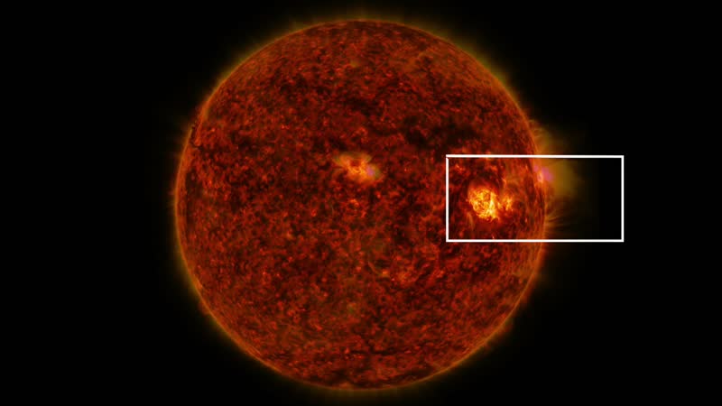
Along with the visible light and warmth constantly emitted by our sun comes a whole spectrum of X-ray and ultraviolet radiation that streams toward Earth. A new CubeSat – a miniature satellite that provides a low-cost platform for missions – is now in space observing a particular class of X-ray light that has rarely been studied. On June 9, 2016, the NASA-funded, bread loaf-sized Miniature X-Ray Solar Spectrometer, o

2016NASA Image and Video Library

NASA Satellite Captures 3-D View Of Hurricane Matthew

NASA’s Global Precipitation Measurement Mission or GPM core satellite captured Hurricane Matthew in 3-D as it made landfall on Haiti and as it travelled up to the Florida coast. GPM flew directly over the storm several times between October 2 - October 6, 2016. The most recent view on October 6 reveals massive amounts of rainfall being produced by the storm as it approaches Florida. The GPM core satellite carries two

2016NASA Image and Video Library

NASA Calculates Matthew's Heavy Rains - Close Up

NASA satellite data was used to provide estimates of Hurricane Matthew's heavy precipitation over the course of seven days. NASA estimates were created from a combination of space-borne passive microwave sensors and showed very heavy rainfall amounts in Matthew's track and over Hispaniola. NASA's Integrated Multi-satellitE Retrievals for GPM or IMERG product is used to make estimates of precipitation from a combinati

2016NASA Image and Video Library

NASA Calculates Matthew's Heavy Rains - Wide Shot

NASA satellite data was used to provide estimates of Hurricane Matthew's heavy precipitation over the course of seven days. NASA estimates were created from a combination of space-borne passive microwave sensors and showed very heavy rainfall amounts in Matthew's track and over Hispaniola. NASA's Integrated Multi-satellitE Retrievals for GPM or IMERG product is used to make estimates of precipitation from a combinati

2016NASA Image and Video Library

Tracing the 2017 Solar Eclipse

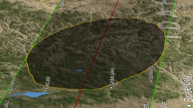
When depicting an eclipse path, data visualizers have usually chosen to represent the moon's shadow as an oval. By bringing in a variety of NASA data sets, visualizer Ernie Wright has created a new and more accurate representation of the eclipse. For the first time, we are able to see that the moon's shadow is better represented as a polygon. This more complicated shape is based NASA's Lunar Reconnaissance Orbiter's

2017NASA Image and Video Library

NASA to Explore Volcanoes, Coral Reefs, and Snowpacks

2016 was a big year for NASA’s field campaigns studying our changing planet, and 2017 will be just as exciting. New Earth science missions include HyspIRI, which will collect data on coral reef health and volcanic gas emissions; PACE, which will monitor the diversity of oceanic phytoplankton and their impact on the marine carbon cycle; and SnowEx, which will help determine how much water is stored in Earth’s terrestr

2017NASA Image and Video Library

SnowEx Field Campaign: B-Roll From Grand Mesa

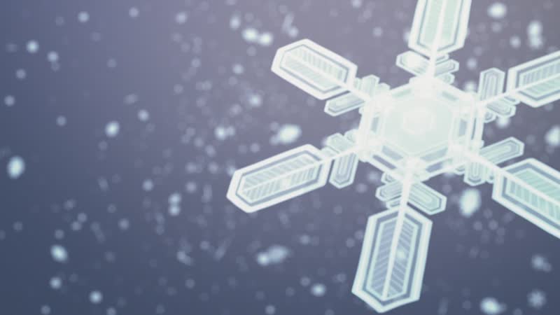
SnowEx is a NASA led multi-year research campaign to improve measurements of how much snow is on the ground at any given time and how much liquid water is contained in that snow. Starting in February, teams of 50 researchers are stationed at Grand Mesa and Senator Beck Basin over a three-week period to measure snow using a variety of snow-sensing instruments and techniques. Ground measurements will allow the team to

2017NASA Image and Video Library

ATom Postcard - Ascension Island to the Azores Islands

The ATom mission aboard NASA’s DC-8 aircraft and flying laboratory is sampling world-wide in one of the most extensive surveys of the atmosphere to date, measuring over 200 gases as well as airborne particles. The science team is particularly interested in methane, tropospheric ozone and black carbon particles, which have strong effects on climate and which all have both human and natural origins.

2017NASA Image and Video Library

How a NASA Science Flight is No Ordinary Journey

A group of scientists and pilots conducted a series of science flights over Western Colorado for a new five-year NASA-led airborne mission called SnowEx. SnowEx is exploring better ways to measuring how much water is stored in snow-covered regions with the goal of eventually creating a future snow satellite mission. More accurate snow measurements will help scientists and decisions-makers better understand our world’